Angkor
The Khmer Empire
Its extent
Khmer (or Angkorian) Empire is the Cambodian kingdom, which existed from the 9th to 15th century, ruled over and/or vassalized most of mainland Southeast Asia and parts of Southern China, stretching from the tip of the Indochinese Peninsula northward to the modern Yunnan province of China, and from Vietnam westward to Myanmar.
Here is a map of the extent of the empire (in red) in the 9th century:
Two religions
The Khmer Empire was a period of religious and cultural exchange between Hinduism and Buddhism. While Hinduism was the predominant religion of the early Khmer Empire, the Khmer king Jayavarman VII introduced Mahayana Buddhism in the 12th century, which became the state religion. Indeed, he did so after a defeat where they almost lost Angkor. Thinking that Hindu gods left them, the king (and the state) turned himself towards buddhism. However, the Khmer people continued to worship Hindu gods alongside Buddhist teachings. The syncretism of both religions can be seen in the carvings and sculptures at temples.
Collapse
The collapse of the Khmer Empire is still a mystery, though it is commonly marked with the Siege of Angkor in 1431. Theories suggest defeats in battle and shifting religious observances, but the more recent studies proposed the environment as a more likely cause of collapse: Strong monsoon rains followed by droughts and floods caused damage to the infrastructure, including the water system, from which Angkor was highly dependent. Such events pushed the ruling class and people towards Phnom Penh over time.
Its capital: Angkor
Angkor was the capital of the Khmer Empire during its peak and was the world’s most extensive pre-industrial urban complex, covering 1,000 km2 with a population of up to one million people. All non-religious buildings were made of perishable materials like wood, even the king and royal family were not allowed to live in the stone houses built for gods. Angkor is known for its vast system of canals, dikes, and reservoirs used for practical purposes such as drinking water and producing wealth-producing crops. This is why all that is left of this civilisation are the temples and the canals.
Angkor nowadays: archaeological park
Angkor archaeological park which can be visited today stretches over some 400 km2, including forested area, and it contains the magnificent remains of the different capitals of the Khmer Empire, from the 9th to the 15th century.
We bought a 3-day pass and cycled around. Overall we visited around 20 temples of the 72 major temples (and remains of several hundred additional minor temples scattered throughout the landscape beyond) in the site, saw the sunrise at Angkor Wat and sunset from Phnom Bakheng, one of the oldest temples in the site from the end of 9th century (as a comparison, Angkor Wat was built in the 12th century). We noted the main temples we visited in the map. It was HOT though, so we tried to start very early and end our daily tour at midday. Luckily, the park is not only about stones but consists of a huge forest, and most of the cycling is possible to be done under the trees and in the forest.
Types of architectures
There are two main architectural structures of the Angkor temples:
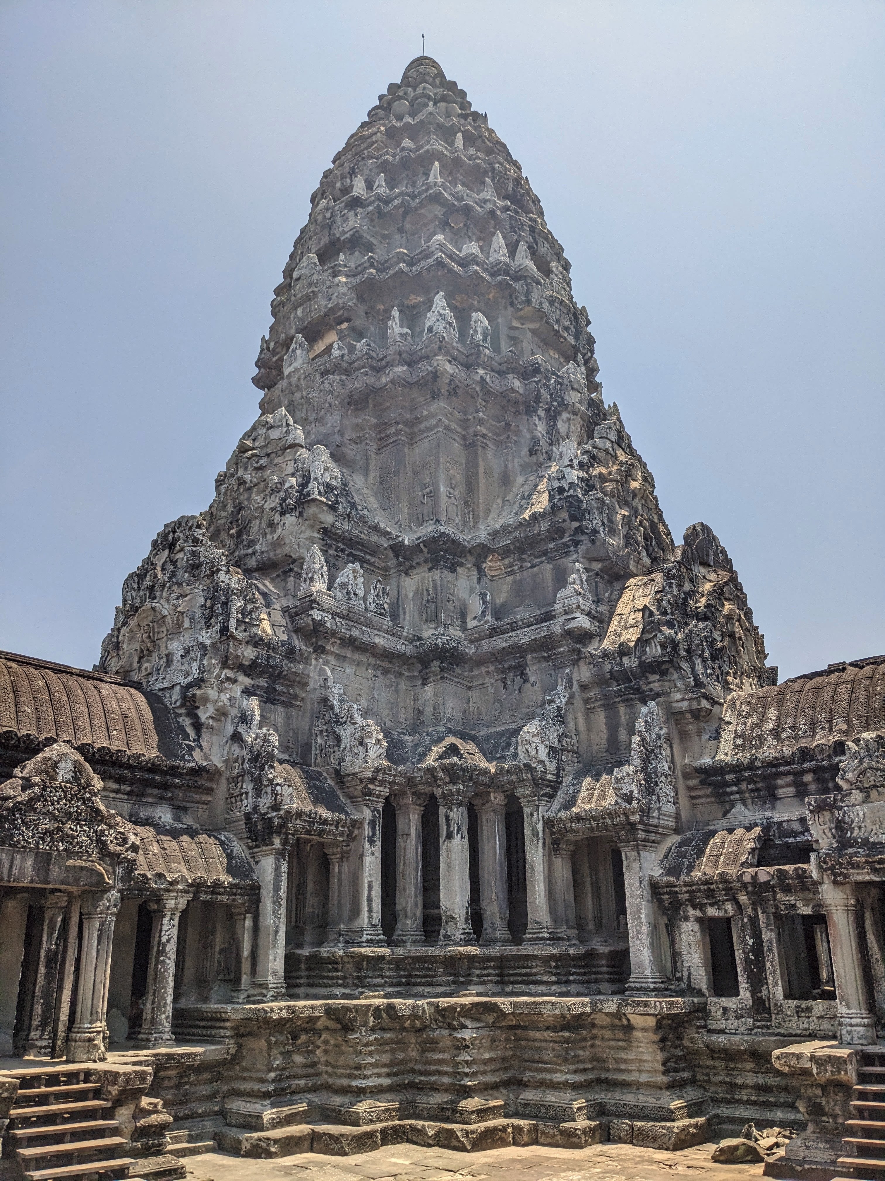
- The temple mountain: symbolizes the mythological sacred 5-peaked Hindu mountain Mount Meru where the Hindu devas reside, these temples usually have walls and moats around them - fitting with the mythological symbol, symbolising the surrounding mountain ranges and ocean around Mount Meru.
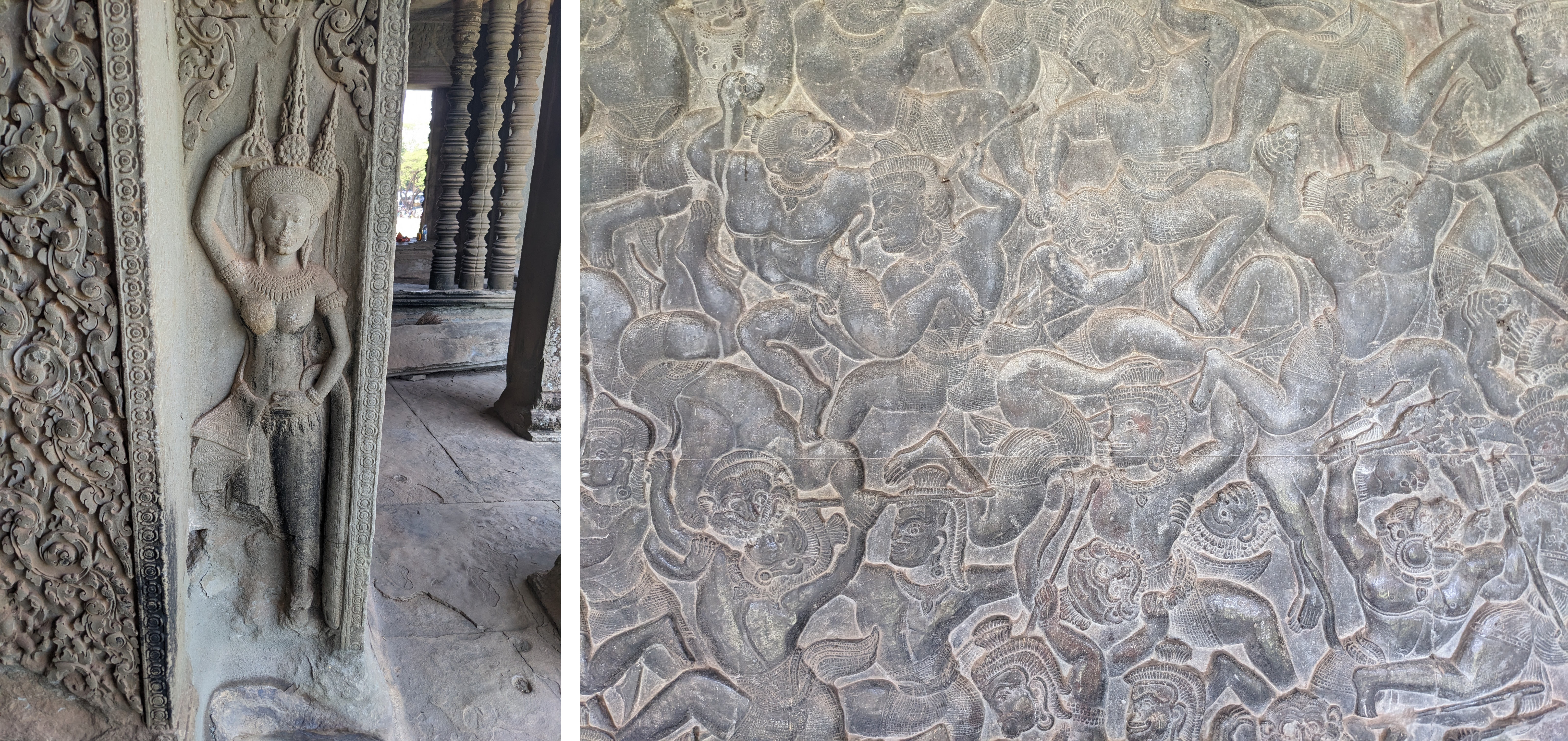
- Structures having walls inside walls forming galleries mostly used for bas-reliefs representing scenes from wars or daily life. A great example of this is the Bayon temple.
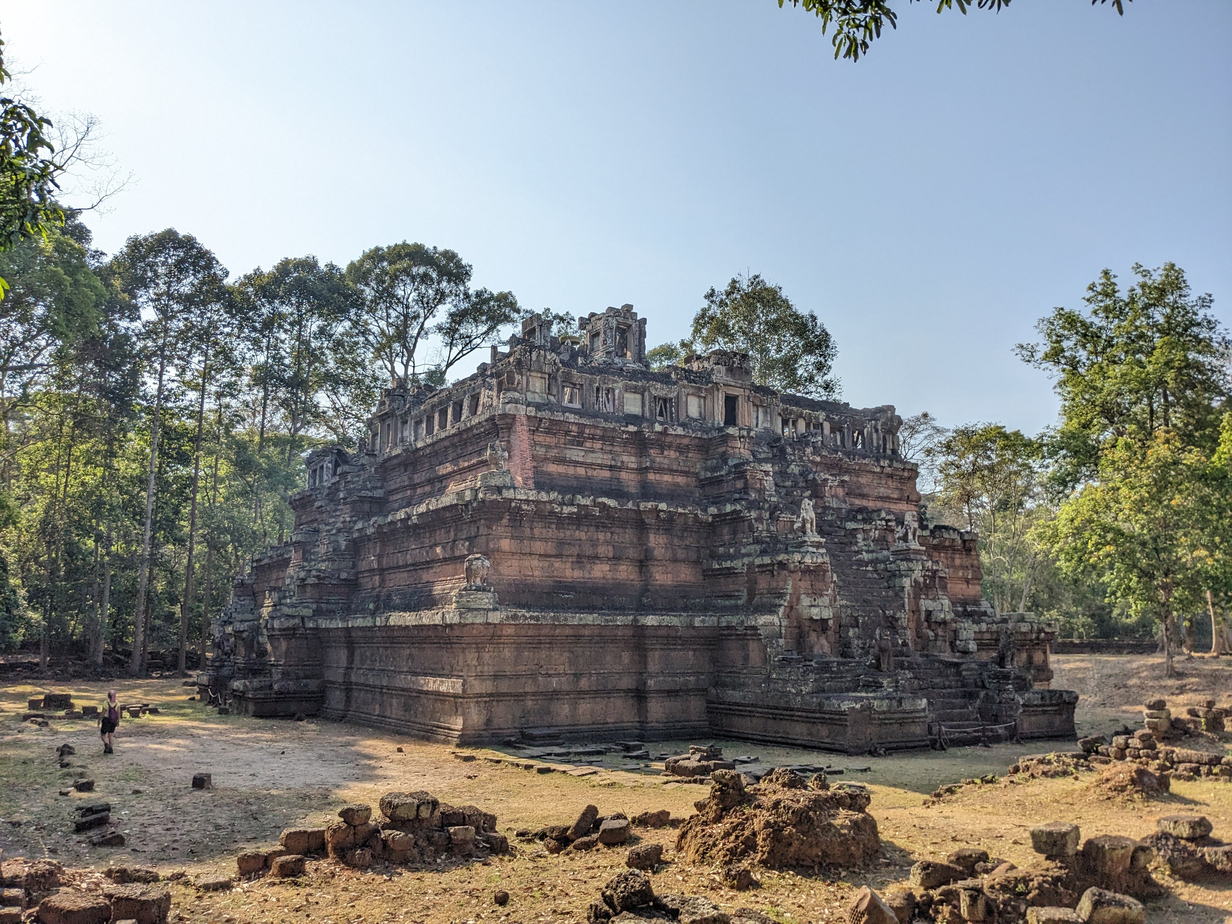
We also noticed that there are two main shapes for temple mountains, either with (usually) 5 towers, such as Angkor Wat, or a pyramid-shape with several tiers, like Phimeanakas. Most of the temple mountains combine these two features though.
Another common feature in Angkor city is srahs and barays; water reservoirs, generally created by excavation and embankment, respectively. It is not clear whether the significance of these reservoirs was religious, agricultural, or a combination of the two.
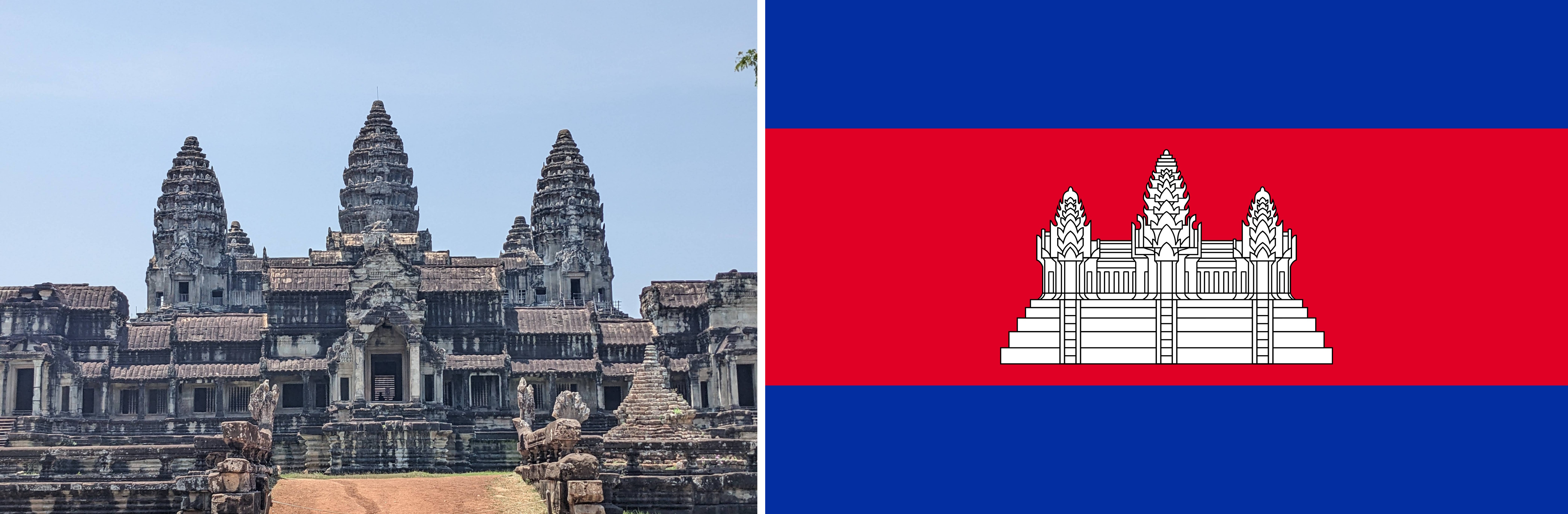
Angkor Wat

The most famous temple in the park, Angkor Wat is the largest religious monument in the world. It was originally constructed as a Hindu temple dedicated to the god Vishnu (breaking the habit of earlier temples being dedicated to Shiva), gradually transforming into a Buddhist temple towards the end of the 12th century.
Angkor Wat has the unique feature of combining the two architectural structures, a 5 towered temple mountain with an extensive gallery section depicting mythological Hindu wars. Our favourite was the monkey war, which is the battle of Lanka, part of the Hindu epic Ramayana (we keep seeing this story since our start of travel in Malaysia!). The battle is fought to rescue Rama’s wife Sita, who was kidnapped by Ravana. The battle is won by Rama with the help of his allies, including Hanuman and his monkey army.
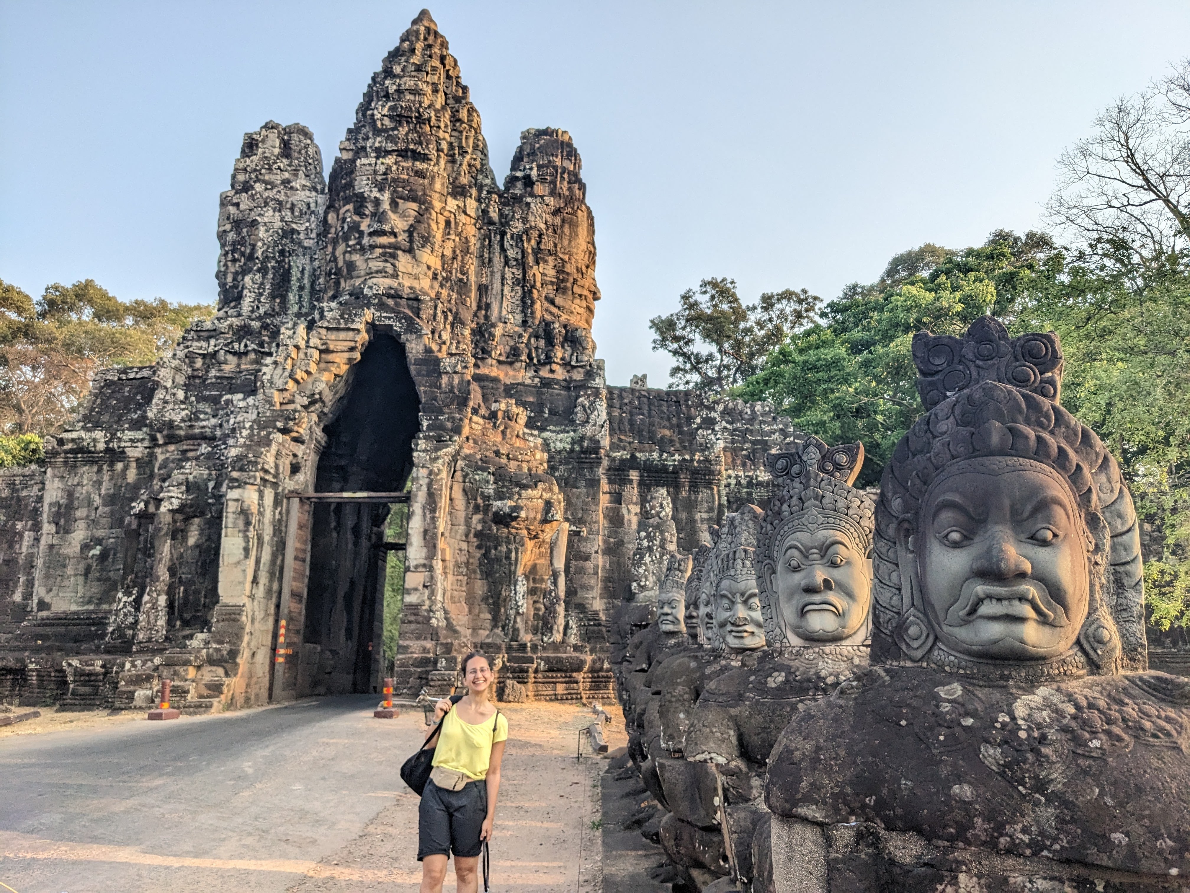
Angkor Thom
Angkor Thom (Great City) was the last and most enduring capital city of the Khmer Empire. It was established in the late twelfth century by King Jayavarman VII. At the centre of the city is Jayavarman’s state temple, the Bayon.
(We couldn’t find clear information on it, but as we understood, Angkor is the name of the whole city where people live and the capital city is used as the presidential area in that city. The capital city moved a couple of times in Ankor limits. It looks like every new king builds their state temple and an area around it becomes the capital city during their reign.)
The gates to the Angkor Thom

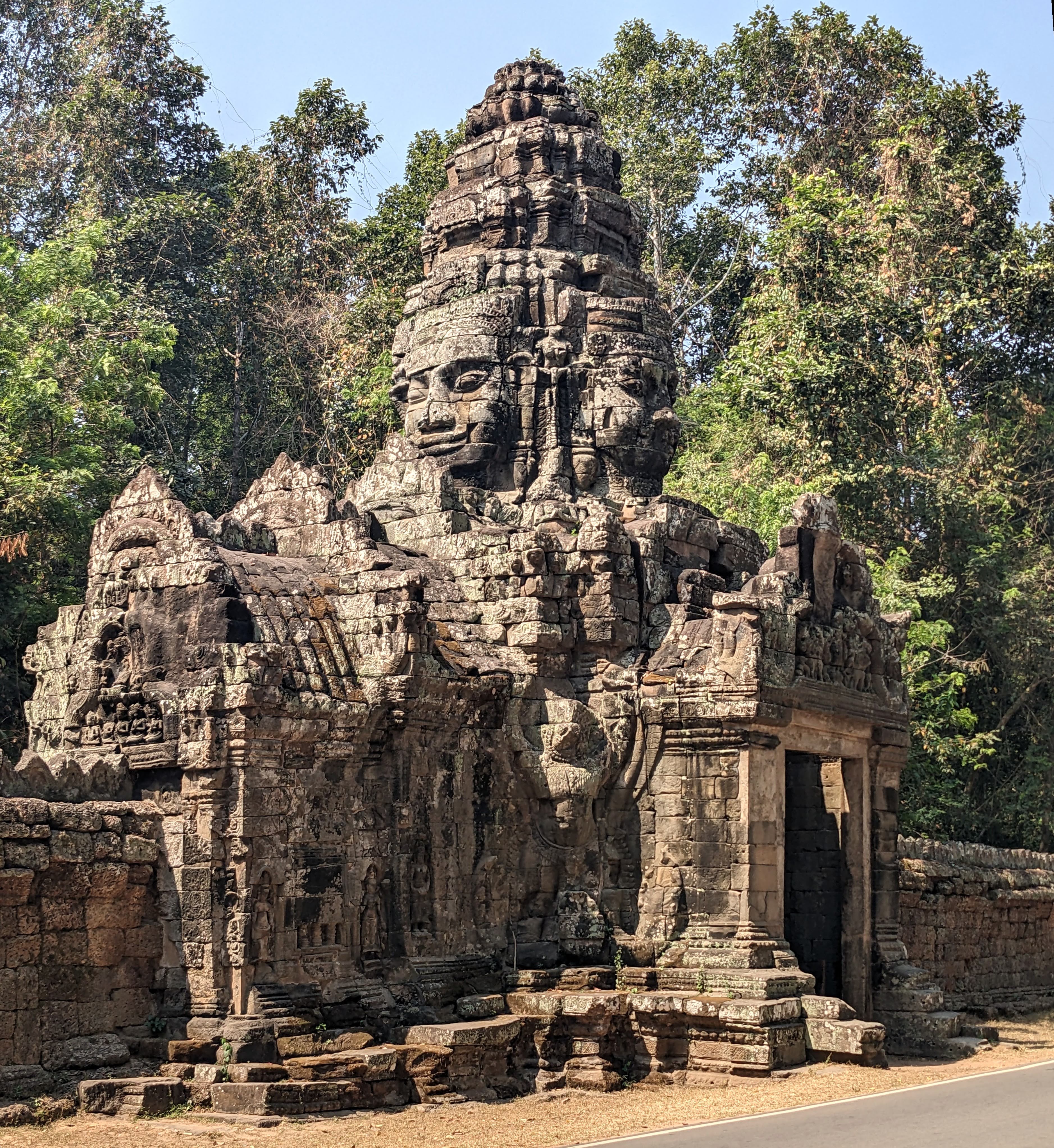
Bayon
The Bayon was built in the late 12th or early 13th century at the centre of Jayavarman’s capital, Angkor Thom. Its most distinctive feature is the multitude of serene and smiling stone faces on the many towers which jut out from the upper terrace and cluster around its central peak (there are hypotheses that the smiling faces are the King Jayavarman himself or Buddha).

The temple is known also for two impressive sets of bas-reliefs, which present an unusual combination of mythological, historical, and mundane scenes. For example, we could see naval battles and life at a market. There is even the depiction of a Khmer rebellion.


Others
We have lots of pictures from Angkor but here are some of our other favourites:
Here is Ta Prohm, this temple is covered by gigantic trees.

Similarly in Ta Som as well:

The Banteay Kdei door:
And us, after a long day of walking, watching the sunset on the top of Phnom Bakheng!
